Blog
USDA Releases New Maps Identifying Major Crop Producing Areas: Alfalfa
A total of 40 new maps have been prepared, showing major crop-producing areas in the United States, China, India, Pakistan, and South Africa. Earlier versions of these maps appeared in the Major World Crop Areas and Climatic Profiles (MWCACP) handbook that contains climatological data, agricultural statistics, and crop calendar information for major agricultural areas worldwide, and serves as a reference for evaluating the effects of weather on world crop production. The new maps, listed by country and commodity, supplement the MWCACP publication by updating illustrations of cropping patterns in these countries:
- United States: barley, corn, cotton, flaxseed, peanuts, rice, sorghum, soybeans, sugarbeets, sugarcane, durum wheat, spring wheat, and winter wheat
- China: corn, cotton, groundnuts, rapeseed, rice, soybeans, sugarcane, and wheat
- India: corn, cotton, groundnuts, rapeseed, rice, soybeans, sugarcane, and wheat
- Pakistan: cotton, rice, and wheat
- South Africa: corn, cotton, oranges, soybeans, sugarcane, sunflowers, and wheat
These maps were developed by the USDA World Agricultural Outlook Board through a contract with the George Mason University Environmental Science and Technology Center. PDF versions of these maps, and the MWCACP publication (1994 revised), are available at: http://www.usda.gov/oce/weather/pubs/Other/MWCACP/index.htm.
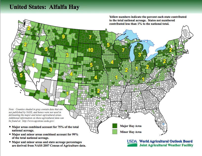
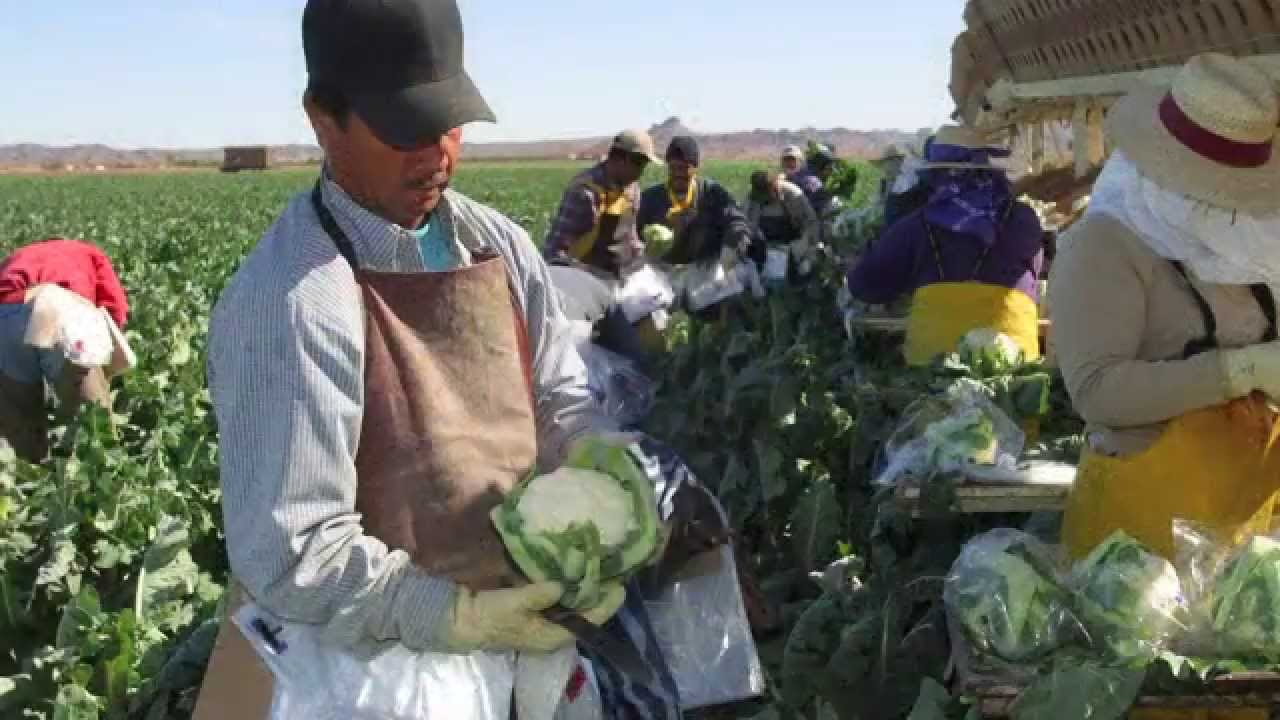
Each week, we here at Fill Your Plate will highlight a different crop grown in the United States. This week, we highlight alfalfa hay. It is grown right here in Arizona, with some parts of our state considered a major hay growing area. You can see a list of our local farmers growing alfalfa here.


Featured Recipes

COTTAGE CHEESE & BLUEBERRY BREAKFAST BAKE
Read More

Warm Your Soul Lasagna Soup
Read More
Pear Lime Jello Salad
Read More